Monday, 11 July 2011

The TMB - Day 7 - June 12th - Along the Swiss Val Ferret

I went over the Grand Col Ferret at about 8am on this gloriously sunny morning. There were tremendous views in both directions ..

Looking back along the Italian Val Ferret from the Grand Col


Looking forward into Switzerland with mist laying in the valley. The two prominent 'big' mountains ahead are Cervino 4478 m, and Monta Rosa 4634 m.


The long descent took me down to the valley road, and into the village Ferret, and a little further-on La Fouly.  Luckily I bought my supplies before the small supermarket closed for a long lunchbreak - from 12 until 3pm! Below the village, the trail followed the river down the valley through open forest, and superb scenery.


There were meadows of wild flowers and many different butterflies to be seen. I think (though not 100% sure) that these are Heath Fritillary ...


Alcon Blue ..


and Pearl-bordered Fritillary ..


High cliffs towered above ..


After a couple of hours of enjoyable walking through the forest, the trail crossed over a huge lateral moraine wall - the "Crête de Saleina" ridge - apparently left behind by a glacier of the same name. At the foot of the moraine wall, began a series of villages along the lower valley. I went through Praz de Fort and Les Arlaches where there were many traditional old  timber buildings.


Above the village of Issert, between the hills, I caught my first glimpse of the day's destination - Champex - a cruel 450 metre climb from the valley. Ouch!


Buildings and shrines along the main street through Issert.

Saturday, 9 July 2011

The TMB - Day 6 - June 11th - Along the Italian Val Ferret.

Wild-camping is frowned-upon along the TMB - and (according to some sources) is illegal in Italy and Switzerland - so it is best to find quiet places. For a couple of days I did just that!


On the undulating grassy ridge of Mont de la Saxe, small pools reflected the grandeur of Les Grandes Jorasses across the Val Ferret.


I continued the climb to Tête de la Tranche 2584 m with superb views back to Courmayeur


It was a short steep descent to Col Sapin 2436 m, where the "official" TMB converges with the easier valley variente route. Next the trail contoured a huge bowl and rose to another high Col; the Pas Entre-deux-Sauts 2524 m.


Plenty of Marmots in many places along the mountain paths ..
More Marmot photos here https://picasaweb.google.com/gordonsimm1/AlpineMarmot


Then it was a long easy descent to Rifugio Bonatti on the edge of Val Ferret, where I saw these King-Cups ..


Rifugio Bonatti - owned by the famous Italian climber -


From Rifugio Bonatti I followed an easy high-level path up the valley towards the next goal; Rifugio Elena at the head of the Italian Val Ferret. It was an excellent trail with fab views all the way. The paths seemed quite benign - but (as on the ridge of Mont de la Saxe yesterday) - I was aware that an over-heavy rucksack - and a momentary loss of balance - could result in a non-recoverable roll to the bottom of the valley! In other words - the slopes were steep and I was watching my step!


The high level path came to an end at a ravine, and I had to go down to the floor of the valley to continue. Here are the views both down, and up the valley, before the descent.


Near to Rifugio Elena (which was closed) I found an unusual bird. My own rarity. I have only seen this species once before (in Lesvos) and I know it doesn't belong in Europe at all!
Click the link to read about the Rufous Bush Chat
http://en.wikipedia.org/wiki/Rufous_Bush_Robin

Rufous Bush Chat, Val Ferret.


This was the view back along the Italian Val Ferret near to Rifugio Elena. Here started the climb towards the Grand Col Ferret 2537 m - and Switzerland.


I hadn't really enough energy for the climb; cold wind and mist started blowing over the Col; so I pitched my tent out-of-sight above the refuge. This was the view next morning ..


Thursday, 7 July 2011

The TMB - Day 5 - June 10th - Through Courmayeur ...

Onwards and upwards ...

This was a hot day and I took it steadily. I planned to buy provisions in Courmayeur, so I struck-camp and headed along the valley into town.


The variente route followed tarmac roads, but the scenery was still spectacular with splendid views of the surrounding mountains, and of the Glacier de la Brenva.


I passed Notre Dame de Guérison and continued around the foot of Mont Chétif. The roadside verges were colourful with a profusion of spring flowers - and butterflies. This was the only part of the trail where I saw the Black-veined White; a large butterfly with semi-transparent wings.


I passed the small town of Entrèves at the Italian end of the Mont Blanc Tunnel. Part of a tunnel-entrance structure can be seen at the bottom of this photo.


I spent some time in Courmayeur stocking-up on food supplies and eventually, with a heavy rucksack, I buckled-down to the inevitable climb out of the valley. The route to Refugio Bertone and beyond proved to be one of the steepest climbs of the Tour, from circa 1150 m altitude to almost 2600 m at Tête de la Tranche. There was a bird's-eye view down to Courmayeur from the tree-line near Rifugio Bertone.


This was the last of a group of buildings near the refuge, and the view beyond is to Col Sapin 2436 m, where two of the TMB varientes for this section converge.


These rock plants were near the refuge.


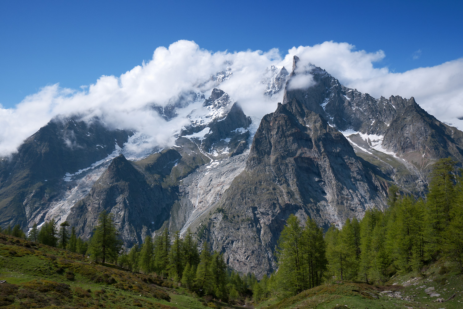
The grassy ridge of Mont de la Saxe beyond Rifugio Bertone is high alpine cattle pasture - in complete contrast to the rocky frozen pinnacles of Les Grandes Jorasses on the opposite side of Val Veni and Val Ferret. The views got better and better as I climbed. I decided to camp along the ridge before reaching Col Sapin and started to look for a level pitch ...


FOOD!  ... at last ... but I had to block the draughts in order to get my kettle boiling.


Tuesday, 5 July 2011

The TMB - Day 4 - June 9th - Rifugio Elisabetta to Courmayeur

From the tranquillity of the wild upper valley down to civilisation; a delectable ramble.

The weather and scenery were quite superb as I hiked the fourth day. The first part was from Elisabetta at 2195 m to Lac de Combal about 5 km down the valley. This seems to be the road-head for anyone wanting to travel up the Val Veni by car, and there is a car-park at the bridge. The lake was created by a natural dam of moraine thrown-up by the Glacier du Miage.
These views are from this first part of the walk. Rifugio Elisabetta can be seen in the first picture, and Lac de Combal with the lateral moraine dam can be seen in the second.

Reminder : You can click the picture to see a larger size, then
use the back button to continue reading


The view looking over Lac de Combal towards Rifugio Elisabetta


From a point near the road-head and lake, I followed the TMB route as it climbed the southern side of Val Veni. This uphill track was directly opposite the Glacier du Miage, and gave fantastic views across the valley of  Italy's longest (about 10 km) and Europe's largest debris-covered glacier. The trail "topped-out" at about 2420 metres.
There was lots of wildlife/bird interest ... I found these Redpolls where the path began to rise through birches


Further on the trail drew parallel with Mont Blanc's south face. In the foreground of this photo lie the skeletal remains of a ruined building.


The views of Mont Blanc were "head-turning" all the way along the Val Veni as I dropped-down to the Col Chécrouit at 1956 metres.


Lunch-stop was at this Shepherd's hut where I saw a Golden Eagle soaring above.


This photo was taken as I crossed a stream, looking across the valley along the length of the Glacier du Miage.


Two more Mont Blanc views - the first one reflected in the waters of a small pool, and the second one over the forested edge of Val Veni.


Finally I reached the Col and took a left turn for the variente route past Rifugio Monte Bianco


I continued down into the valley to pitch my tent at "Camping Monte Bianco La Sorgente" beside the river.